Stage 16: Paliri → Conca
11.5 km from Refuge d'I Paliri (1055 m) to Conca (252 m), with 420 m of ascent and 1230 m of descent.
Walking time by fitness profile
| Fitness profile | Walking time |
|---|---|
| Trail runner (fast & light, long days) | 2h41 |
| Fit / sportive (strong hiker, big days) | 3h48 |
| Multiday hiker (classic GR20 pace) | 5h00 |
| Relaxed (steady, shorter days) | 6h00 |
Times computed with the RandoNav planning algorithm. Breaks not included.
On the trail
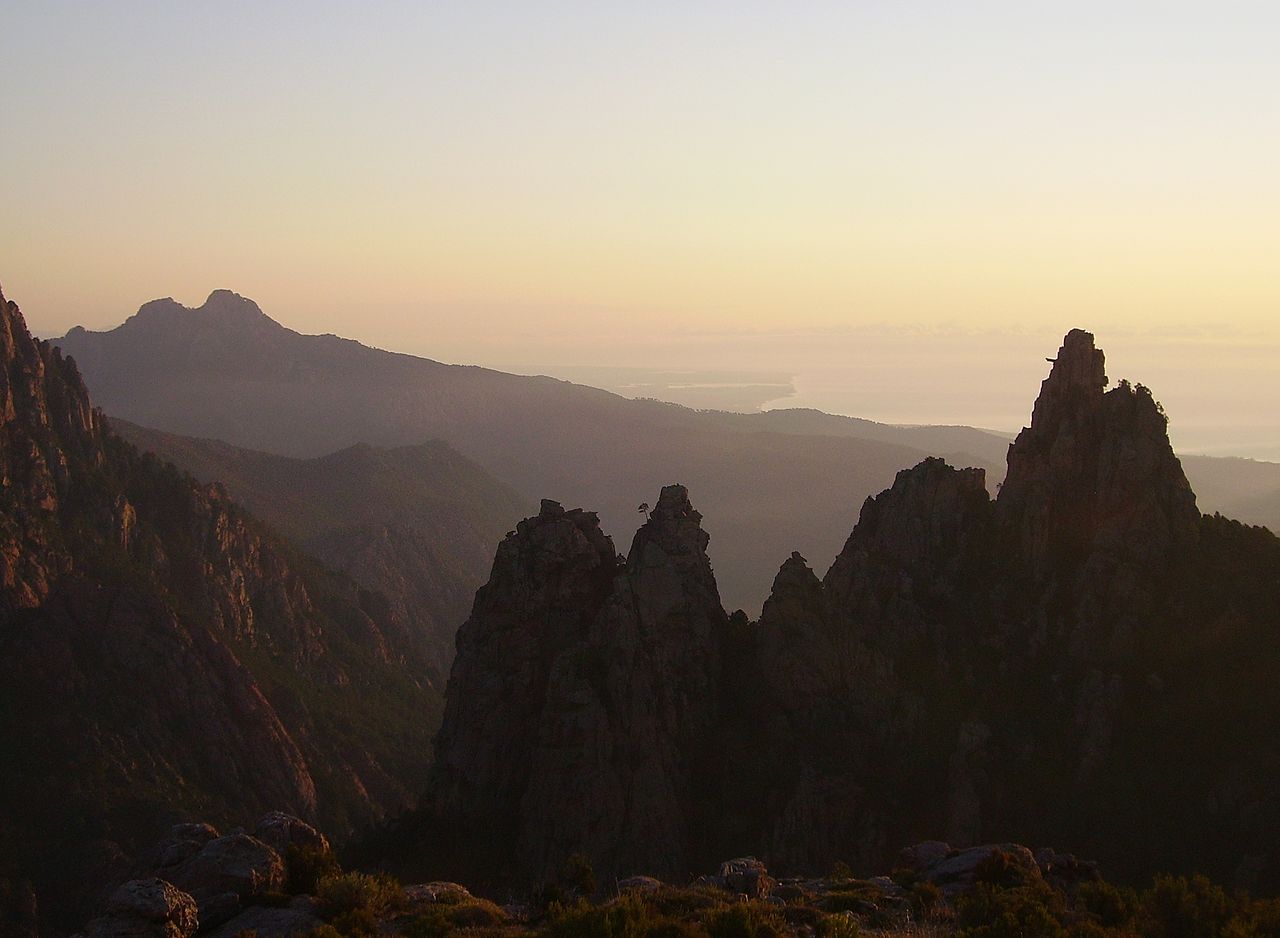
The last day begins gently, almost reluctantly, as the trail leaves Paliri through pine and arbutus with the Bavella towers throwing long morning shadows behind you. There's one final flourish — the curious slot of the Bocca d'Usciolu, a person-wide notch in the granite crest that the GR20 squeezes through like a turnstile — and then the long descent south begins, 1,200 m of it, into an increasingly Mediterranean world of maquis, juniper and heat shimmer. Start early and carry water: the south-facing slopes cook by late morning, and the sea filling the horizon does nothing to cool them.
And then, suddenly, it's over. The path drops past a last water point, turns a corner, and delivers you into Conca at 252 m, where the village bar has watched two weeks of effort dissolve into cold beer for generations of hikers — the traditional finish-line ritual, and not one to skip. Sign nothing, prove nothing; the state of your boots says it all. From Calenzana to Conca, roughly 180 km of granite, maquis and cowbells: you've just walked the hardest, and possibly the finest, long-distance trail in Europe.
Start / end
The last refuge — quiet, scenic spot in the forest at 1055 m with views of the Bavella needles behind you.
About this stage
Stage 16 links Refuge d'I Paliri (1055 m) with Conca (252 m) over 11.5 km, climbing 420 m and descending 1230 m. This stage lies in the southern half of the GR20 (after Vizzavona), which is greener and slightly gentler than the north. Water is available at every stop on this stage.
Walk this stage your way
The free RandoNav planner splits the GR20 into realistic days for YOUR fitness level — with offline maps and morning briefings.
Plan my GR20 →